- Home
- A Renaissance monument
- The monarchy and the lighthouses of the 17th century
- The fire towers designed by military engineers
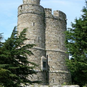
It was not until the end of the seventeenth century, seventy years after Cordouan was built, that new structures lit up the coasts of France. The centralised royal authority asserted its power through military and scientific control of its territory. The conquest began with the tasks of mapmaking – which was entrusted to geographers at the Observatoire de Paris – and the physical and symbolic construction of a modern concept of France's borders. It was the time of the Pré Carré and of Vauban's fortifications. The king also wanted to build a powerful navy and to control the country's shorelines. Colbert's Grande Ordonnance sur la Marine of 1681 transformed royal will into policy, unifying customary coastal law and creating government administrations. Under Vauban's leadership, fortification engineers included several fire towers in their coastal defence plans; the architecture of these military structures was much simpler than that of Cordouan. At the top of the towers was a hearth where wood, and later coal, was burned, hence the name "fire tower". To ensure the safety of ships approaching La Rochelle and the Rochefort arsenal (whose construction had begun in 1666), two towers were built at the tips of the Ile de Ré and the Ile d'Oléron in 1682 and 1685, respectively. A tower at the Abbaye Saint-Mathieu de Fine-Terre (1692) and the Stiff tower on the Ile d'Ouessant (1699) provided guidance for royal ships sailing into the military port at Brest. At Cap Fréhel, the Messieurs de Saint-Malo paid for a structure, which was replaced in 1702 by a fortification designed by the engineer Siméon Garengeau. These early towers were used for both defence purposes and for lighting the shores, and were tightly controlled by the military engineers. In the eighteenth century, at the behest of the Rouen chamber of commerce, new lighthouses were built at Barfleur, La Hève and l'Ailly. Together with Cordouan and several port-based fire towers, they represented the first network of lighthouses in France.


